

Ephemera

c1935 SUPER RARE MELBOURNE STEAMSHIP LINE TSMV DUNTROON SHIPS CREW LARGE PHOTO.
$349
Possibly taken to celebrate it’s maiden voyage undertaken in 1935, definately pre WW2. Sold with an unused postcard of the same period. Photograph size 20.5cms x 16cms, overall matted size 30...

1819 RARE LARGE DETAILED MAP OF CHESHIRE, UK. MATTED READY TO FRAME.
$299
Published in London 1819 by Lackington & Co. Noted is a vertical fold / crease line through the middle, some age foxing & ghosting otherwise in great condition. It has been professionally matted...

1890 SUPER RARE VERY LARGE OFFICIAL QLD GOV MAP OF “ENVIRONS of NORMANTON"
$599
Virtually impossible to buy !!! Officially printed & published at the Surveyors General Office, Brisbane 1890. It depicts the “Environs of Normanton", with the Gulf of Carpentaria top left. It...

1895 LARGE COLOUR MAP of OXFORD, UK. MATTED READY TO FRAME.
$150
It has been professionally matted on acid free purple card, ready to frame. The map measures 30cms x 37cms, overall matted size is 46cms x 58cms, some fold marks. Note: The poster is sealed in...

RARE 100% GENUINE 1671 HANDCOLOURED MAP OF WILTSHIRE, UK with GLOCESTER HUNDREDS
$499
Printed in London for Ric. Blome (Richard Blome) & dated 1671 with the scale in miles. Still retains good colour after 350 years. It has been professionally matted on acid free white card, ready to...

1922 SUPERB SCARCE LARGE MAP of SPAIN & PORTUGAL - WESTERN SECTION. VERY NICE!
$99
This is a large double page map measuring 45cms x 58cms. It’s ex “The Times Survey Atlas of the World” 1922 & was prepared at the Edinburgh Geographical Institute under the direction of J G...

1922 SUPERB SCARCE LARGE MAP of SPAIN & PORTUGAL - EASTERN SECTION. VERY NICE!
$99
This is a large double page map measuring 45cms x 58cms. It’s ex “The Times Survey Atlas of the World” 1922 & was prepared at the Edinburgh Geographical Institute under the direction of J G...

1922 SUPERB SCARCE LARGE MAP of SOUTHERN ITALY. VERY NICE!
$99
This is a large double page map measuring 45cms x 58cms. It’s ex “The Times Survey Atlas of the World” 1922 & was prepared at the Edinburgh Geographical Institute under the direction of J G...

1922 SUPERB SCARCE LARGE MAP of NORTHERN ITALY, AUSTRIA ETC. VERY NICE!
$99
This is a large double page map measuring 45cms x 58cms. It’s ex “The Times Survey Atlas of the World” 1922 & was prepared at the Edinburgh Geographical Institute under the direction of J G...

1922 SUPERB SCARCE LARGE MAP of SOUTH AFRICA. VERY NICE!
$99
This is a large double page map measuring 45cms x 58cms. It’s ex “The Times Survey Atlas of the World” 1922 & was prepared at the Edinburgh Geographical Institute under the direction of J G...

1922 SUPERB SCARCE LARGE MAP of “SIBERIA". VERY NICE!
$99
This is a large double page map measuring 45cms x 58cms. It’s ex “The Times Survey Atlas of the World” 1922 & was prepared at the Edinburgh Geographical Institute under the direction of J G...

1922 SUPERB SCARCE LARGE MAP of “WORLD - POLITICAL". VERY NICE!
$99
This is a large double page map measuring 45cms x 58cms. It’s ex “The Times Survey Atlas of the World” 1922 & was prepared at the Edinburgh Geographical Institute under the direction of J G...

1922 SUPERB SCARCE LARGE MAP of “EASTERN EUROPE - COMMUNICATIONS". VERY NICE!
$99
This is a large double page map measuring 45cms x 58cms. It’s ex “The Times Survey Atlas of the World” 1922 & was prepared at the Edinburgh Geographical Institute under the direction of J G...

1922 SUPERB SCARCE LARGE MAP of “WESTERN EUROPE - COMMUNICATIONS". VERY NICE!
$99
This is a large double page map measuring 45cms x 58cms. It’s ex “The Times Survey Atlas of the World” 1922 & was prepared at the Edinburgh Geographical Institute under the direction of J G...

1922 SUPERB SCARCE LARGE MAP of “NEW ZEALAND". VERY NICE!
$99
This is a large double page map measuring 45cms x 58cms. It’s ex “The Times Survey Atlas of the World” 1922 & was prepared at the Edinburgh Geographical Institute under the direction of J G...

1922 SUPERB SCARCE LARGE MAP of “EASTERN QUEENSLAND". VERY NICE!
$99
This is a large double page map measuring 45cms x 58cms. It’s ex “The Times Survey Atlas of the World” 1922 & was prepared at the Edinburgh Geographical Institute under the direction of J G...

1922 SUPERB SCARCE LARGE MAP of “ARGENTINA, CHILI ETC. VERY NICE!
$99
This is a large double page map measuring 45cms x 58cms. It’s ex “The Times Survey Atlas of the World” 1922 & was prepared at the Edinburgh Geographical Institute under the direction of J G...

1922 SUPERB SCARCE LARGE MAP of SWITZERLAND. VERY NICE!
$99
This is a large double page map measuring 45cms x 58cms. It’s ex “The Times Survey Atlas of the World” 1922 & was prepared at the Edinburgh Geographical Institute under the direction of J G...

1922 SUPERB SCARCE LARGE MAP of NORTHERN RUSSIA & FINLAND. VERY NICE!
$99
This is a large double page map measuring 45cms x 58cms. It’s ex “The Times Survey Atlas of the World” 1922 & was prepared at the Edinburgh Geographical Institute under the direction of J G...

1922 SUPERB SCARCE LARGE MAP of EGYPT and the NILE. VERY NICE!
$99
This is a large double page map measuring 45cms x 58cms. It’s ex “The Times Survey Atlas of the World” 1922 & was prepared at the Edinburgh Geographical Institute under the direction of J G...

1922 SUPERB SCARCE LARGE MAP of LOWER EGYPT. VERY NICE!
$99
This is a large double page map measuring 45cms x 58cms. It’s ex “The Times Survey Atlas of the World” 1922 & was prepared at the Edinburgh Geographical Institute under the direction of J G...

RARE 1816 COPPERPLATE ENGRAVE MAP “BRITISH CHANNEL” SHOWING INVASION DATES SITES
$459
An unusual map / chart, showing the “British Channel” with England on one side & France on the other with various Invasion Dates & Sites chronicled in a chart listed in ascending date order...

1922 SUPERB SCARCE LARGE MAP of “SOUTH AUSTRALIA". VERY NICE!
$99
This is a large double page map measuring 45cms x 58cms. It’s ex “The Times Survey Atlas of the World” 1922 & was prepared at the Edinburgh Geographical Institute under the direction of J G...

1922 SUPERB SCARCE LARGE MAP of “VICTORIA & TASMANIA". VERY NICE!
$99
This is a large double page map measuring 45cms x 58cms. It’s ex “The Times Survey Atlas of the World” 1922 & was prepared at the Edinburgh Geographical Institute under the direction of J G...

1922 SUPERB SCARCE LARGE MAP of “FRANCE - NORTH WESTERN SECTION". VERY NICE!
$99
This is a large double page map measuring 45cms x 58cms. It’s ex “The Times Survey Atlas of the World” 1922 & was prepared at the Edinburgh Geographical Institute under the direction of J G...
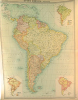
1922 SUPERB SCARCE LARGE MAP of “SOUTH AMERICA - POLITICAL". VERY NICE!
$99
This is a large double page map measuring 45cms x 58cms. It’s ex “The Times Survey Atlas of the World” 1922 & was prepared at the Edinburgh Geographical Institute under the direction of J G...

RARE SUPERB 1809 COPPERPLATE ENGRAVING. "DEATH of JOHN MOORE, BATTLE of CORUNNA"
$199
C Warren engraver & published by J Stratford, December 2nd 1809. Overall measures 23cms x 37
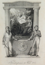
RARE SUPERB 1817 COPPERPLATE ENGRAVING. ‘FRONTPIECE to VOL 2nd” BOOKPLATE.
$199
S Edwards, engraver & published by Nuttall, Fisher & Dixon, March 1817. Frontpiec

RARE 1813 COPPERPLATE ENGRAVING. "DESTRUCTION of a FRENCH SQUADRON"
$229
C Warren, engraver & published by J Stratford, March 12th 1813. Overall measures 23cms x 37c

SUPER RARE 1816 LONG GENEALOGICAL CHART / KINGS OF ENGLAND 800AD - 1816AD
$599
More than likely from a book, “History of England” published in 1817. The table has been divided into 4 sections, with each section showing a detailed line of succession & lineage. It's a long...

1922 SUPERB SCARCE LARGE MAP of “INDIAN OCEAN". VERY NICE!
$99
This is a large double page map measuring 45cms x 58cms. It’s ex “The Times Survey Atlas of the World” 1922 & was prepared at the Edinburgh Geographical Institute under the direction of J G...

1922 SUPERB SCARCE LARGE MAP of “TOWNS of ENGLAND & SCOTLAND". VERY NICE!
$99
This is a large double page map measuring 45cms x 58cms. It’s ex “The Times Survey Atlas of the World” 1922 & was prepared at the Edinburgh Geographical Institute under the direction of J G...

1922 SUPERB SCARCE LARGE MAP of BRITISH ISLES - RAILWAYS & INDUSTRIAL. VERY NICE
$99
This is a large double page map measuring 45cms x 58cms. It’s ex “The Times Survey Atlas of the World” 1922 & was prepared at the Edinburgh Geographical Institute under the direction of J G...

1922 SUPERB SCARCE LARGE MAP of “NORTH PACIFIC OCEAN". VERY NICE!
$99
This is a large double page map measuring 45cms x 58cms. It’s ex “The Times Survey Atlas of the World” 1922 & was prepared at the Edinburgh Geographical Institute under the direction of J G...

1922 SUPERB SCARCE LARGE MAP of “NORTHERN AFRICA". VERY NICE!
$99
This is a large double page map measuring 45cms x 58cms. It’s ex “The Times Survey Atlas of the World” 1922 & was prepared at the Edinburgh Geographical Institute under the direction of J G...