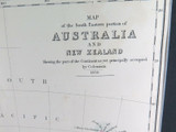
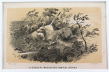
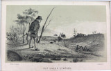
RARE 1859 COLONIAL MAP of AUSTRALIA & NEW ZEALAND ex “RAMBLES in the ANTIPODES”

$259
Condition:
Used
Shipping:
$8 (Fixed Shipping Cost)
Current stock: 0
Description

Description

 This map was published in the 1859 book “Rambles in the Antipodes” by Edward Wilson. It depicts …. The South Eastern Portion of Australia and New Zealand occupied by Colonists …. It has been professionally matted on acid free cardboard ready to frame. The overall size is quite large at 49cms x 45.5cms, the map size is 26.5cms x 21cms. Considering it's over 160 years old it’s in nice condition, it has fold lines and some minor marks, foxing, toned in some areas. NOTE: The map may have been produced in 1858 as Queensland is not yet a state, as it still forms part of New South Wales.
Reviews

Reviews (0)

Be the first to review this product.
Additional Info

Additional Info

Condition:
Used
Shipping:
$8 (Fixed Shipping Cost)

Related Products